Downstream
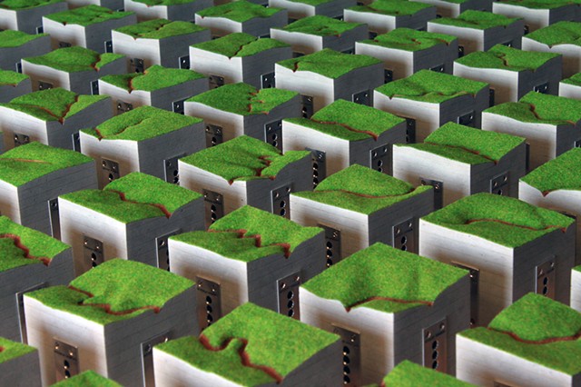
“Downstream” is a representation of the Catawba/Wateree, Cape Fear, Dan, Keowee/Toxaway, Neuse, and Yadkin/Pee Dee river systems. Each river’s path and surrounding topography has been developed as a singular composition that is divided into 25 equal segments. Water Resources Fund grant recipients will receive one section of the composition that illustrates the river with which they are working.
Homasote and model landscaping has been used to represent each region’s topography, and the carved riverbed is surfaced with soil collected from the bank of the river that is the focus of each group’s study. Water samples are embedded on each side of the segments also collected from each of the river systems. They are included on every piece of the composition as a reminder of the many regions touched by this fund.
It is my intent that each object, being one of many will serve as a reminder that although the efforts that are supported by each Water Resources Fund grant may focus on one small part of the region, there are countless others living and working downstream who will feel its effects.
